Portal:Tropical cyclones
The Tropical Cyclones Portal
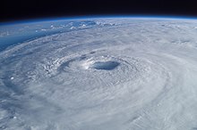
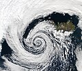
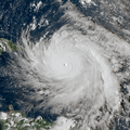
A tropical cyclone is a storm system characterized by a large low-pressure center, a closed low-level circulation and a spiral arrangement of numerous thunderstorms that produce strong winds and heavy rainfall. Tropical cyclones feed on the heat released when moist air rises, resulting in condensation of water vapor contained in the moist air. They are fueled by a different heat mechanism than other cyclonic windstorms such as Nor'easters, European windstorms and polar lows, leading to their classification as "warm core" storm systems. Most tropical cyclones originate in the doldrums, approximately ten degrees from the Equator.
The term "tropical" refers to both the geographic origin of these systems, which form almost exclusively in tropical regions of the globe, as well as to their formation in maritime tropical air masses. The term "cyclone" refers to such storms' cyclonic nature, with anticlockwise rotation in the Northern Hemisphere and clockwise rotation in the Southern Hemisphere. Depending on its location and intensity, a tropical cyclone may be referred to by names such as "hurricane", "typhoon", "tropical storm", "cyclonic storm", "tropical depression" or simply "cyclone".
Types of cyclone: 1. A "Typhoon" is a tropical cyclone located in the North-west Pacific Ocean which has the most cyclonic activity and storms occur year-round. 2. A "Hurricane" is also a tropical cyclone located at the North Atlantic Ocean or North-east Pacific Ocean which have an average storm activity and storms typically form between May 15 and November 30. 3. A "Cyclone" is a tropical cyclone that occurs in the South Pacific and Indian Oceans.
Selected named cyclone -
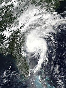
Hurricane Isaias (/ˌisɑːˈiːɑːs/) was a destructive Category 1 hurricane that caused extensive damage across the Caribbean and the East Coast of the United States while also spawning the strongest tropical cyclone-spawned tornado since Hurricane Rita in 2005. The ninth named storm and second hurricane of the extremely active and record-breaking 2020 Atlantic hurricane season, Isaias originated from a vigorous tropical wave off the coast of Africa that was first identified by the National Hurricane Center on July 23. The tropical wave gradually became more organized and obtained gale-force winds on July 28 before organizing into Tropical Storm Isaias on July 30. Isaias marked the earliest ninth named storm on record, surpassing 2005's Hurricane Irene by eight days. Isaias strengthened into a Category 1 hurricane on the next day, reaching an initial peak of 85 mph (137 km/h), with a minimum central pressure of 987 mbar (hPa; 29.15 inHg). On August 1, the storm made landfall on North Andros, Bahamas and subsequently weakened to a tropical storm, before paralleling the east coast of Florida and Georgia. As Isaias approached the Carolina coastline, it reintensified back into a hurricane. Soon afterward, Isaias reached its peak intensity, with maximum 1-minute sustained winds of 90 mph (140 km/h) and a minimum central pressure of 986 millibars (29.1 inHg), before making landfall near Ocean Isle Beach, North Carolina, at 03:10 UTC on August 4, at the same intensity. The storm proceeded to accelerate up the East Coast of the United States as a strong tropical storm, before transitioning into an extratropical cyclone over Quebec on August 4. Isaias's extratropical remnants persisted for another day, before dissipating on August 5.
Numerous tropical storm watches and warnings as well as hurricane watches and hurricane warnings were issued for the Lesser Antilles, Greater Antilles, Bahamas, Cuba, and the East Coast of the United States. Isaias impacted portions of the Eastern Caribbean and caused significant damage in the Eastern United States. Devastating flooding and wind damage were reported in Puerto Rico and the Dominican Republic, with many towns without electricity or drinking water. Trees were uprooted and power lines were downed in much of the Eastern United States from both damaging winds and tornadoes, with more than 3 million power outages reported, nearly half of them in New Jersey. Isaias was also the second tropical cyclone to affect the Northeastern States in 3 weeks after Tropical Storm Fay in early July. Many people were without power for days after the storm in New York and Connecticut, leading to investigations into power and electricity companies. There were 17 storm-related deaths (direct and indirect): 14 in the contiguous United States, two in the Dominican Republic, and one in Puerto Rico. Overall, Isaias caused approximately $5.025 billion (2020 USD) in damage, with $4.8 billion in damage occurring in the U.S. alone, making Isaias the costliest tropical cyclone to affect the Northeastern United States since Hurricane Sandy in 2012. The Spanish name Isaias was found by many people to be difficult to enunciate, and was mispronounced by some weather forecasters in the United States. Isaias was one of several destructive 2020 hurricanes whose names were not retired by the World Meteorological Organization following the season, along with: Sally, Delta, and Zeta. (Full article...)Selected article -
The effects of Hurricane Charley in Jamaica included one fatality and at least $4.1 million in damages. Forming out of a tropical wave on August 9, 2004, Charley quickly tracked through the eastern Caribbean and attained tropical storm status on August 10. While passing south of Jamaica on August 11, the storm was upgraded to a Category 1 hurricane. During its passage of Jamaica, Charley had maximum winds of 75 mph (120 km/h), a low-end Category 1 hurricane. Turning north, the storm impacted western Cuba as a Category 3 storm before making landfall in Florida as a strong Category 4. The storm eventually dissipated on August 15. As Charley approached Jamaica, officials issued tropical storm watches and warnings before issuing a hurricane watch. Two cruise ships were diverted from docking in Jamaica, affecting 5,700 passengers. Numerous shelters were set up across the island; however, relatively few people sought refuge in them.
Although it was only a Category 1 hurricane, Charley caused significant damage in southern Jamaica. Saint Elizabeth Parish sustained the worst damage. About 750 farmers reported damage, and at one point, flooding isolated 30 families. The only fatality in Jamaica occurred after a man attempted to rescue a family but was swept away by flood waters. Following the storm, search and rescue teams were deployed to flooded regions. Days later, officials allocated roughly $7.6 million (JMD; US$86,000) to repair damaged roads. Residents in areas that sustained severe agricultural losses also requested assistance from the government. (Full article...)Selected image -

Selected season -

The 2018 Pacific hurricane season was one of the most active Pacific hurricane seasons on record, producing the highest accumulated cyclone energy value on record in the basin. The season had the fourth-highest number of named storms – 23, tied with 1982. The season also featured eight landfalls, six of which occurred in Mexico. The season officially began on May 15 in the Eastern Pacific, and on June 1 in the Central Pacific; they both ended on November 30. These dates conventionally delimit the period of each year when most tropical cyclones form in the Pacific basin. However, tropical cyclone formation is possible at any time of the year, as illustrated when the first tropical depression formed on May 10, five days prior to the official start of the season.
The second named storm of the season, Hurricane Bud, struck Baja California Sur in mid-June, causing minor damage. Tropical Storm Carlotta stalled offshore of the Mexican coastline, where it also caused minor damage. In early August, Hurricane Hector became one of the few tropical cyclones to cross into the Western Pacific from the Eastern Pacific, while also affecting Hawaii. Tropical Storm Ileana brought torrential rainfall to southwestern Mexico during early August, causing relatively minor damage. A few weeks later, Hurricane Lane obtained Category 5 intensity while also becoming Hawaii's wettest tropical cyclone on record and the second wettest tropical cyclone in United States history, only behind Hurricane Harvey of the previous year. Hurricane Olivia also struck Hawaii, resulting in relatively minor damage. (Full article...)Related portals
Currently active tropical cyclones

Italicized basins are unofficial.
- North Atlantic (2024)
- No active systems
- East and Central Pacific (2024)
- No active systems
- Mediterranean (2023–24)
- No active systems
- South-West Indian Ocean (2023–24)
- No active systems
- Australian region (2023–24)
- No active systems
- South Pacific (2023–24)
- No active systems
- South Atlantic (2023–24)
- No active systems
Last updated: 18:32, 26 May 2024 (UTC)
Tropical cyclone anniversaries

May 30
- 1959 - Tropical Storm Arlene made landfall in Louisiana as a minimal tropical storm, causing $500,000 worth of damage in the Southeastern United States.
- 2008 - Tropical Storm Alma (pictured) affects much of Central America with torrential rainfall. Four people died while seven people remained missing from the storm. Damages were estimated to be about US$35 million.

May 31
- 1997 - Typhoon Marie reached its peak intensity with winds of 165 km/h (105 mph) in the open Pacific Ocean. Marie did not affect land.
- 2008 - Tropical Storm Arthur (pictured) makes landfall over Belize. Damages were estimated to be around US$78 million due to extensive rainfall.

June 1,
- 2007 - Tropical Storm Barbara (pictured) starts weakening as it was reported that it had damages a total of US$55 million and killed 4 people.
- 2024 - The Central Pacific and Atlantic hurricane seasons officially begin.
Did you know…


- …that the Joint Typhoon Warning Center considers that Typhoon Vera (pictured) of 1986 is actually two distinct systems, formed from two separated low-level circulations?
- …that Hurricane Agatha (pictured) was the strongest Pacific hurricane to make landfall in Mexico in May since records began in 1949?
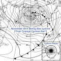
- …that Cyclone Raquel (track pictured) travelled between the Australian and South Pacific basins between the 2014–15 and 2015–16 seasons, spanning both seasons in both basins?
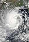
- …that Cyclone Amphan (pictured) in 2020 was the first storm to be classified as a Super Cyclonic Storm in the Bay of Bengal since 1999?
General images -

Topics
Subcategories
Related WikiProjects
WikiProject Tropical cyclones is the central point of coordination for Wikipedia's coverage of tropical cyclones. Feel free to help!
WikiProject Weather is the main center point of coordination for Wikipedia's coverage of meteorology in general, and the parent project of WikiProject Tropical cyclones. Three other branches of WikiProject Weather in particular share significant overlaps with WikiProject Tropical cyclones:
- The Non-tropical storms task force coordinates most of Wikipedia's coverage on extratropical cyclones, which tropical cyclones often transition into near the end of their lifespan.
- The Floods task force takes on the scope of flooding events all over the world, with rainfall from tropical cyclones a significant factor in many of them.
- WikiProject Severe weather documents the effects of extreme weather such as tornadoes, which landfalling tropical cyclones can produce.
Things you can do
 |
Here are some tasks awaiting attention:
|
Wikimedia
The following Wikimedia Foundation sister projects provide more on this subject:
-
Commons
Free media repository -
Wikibooks
Free textbooks and manuals -
Wikidata
Free knowledge base -
Wikinews
Free-content news -
Wikiquote
Collection of quotations -
Wikisource
Free-content library -
Wikiversity
Free learning tools -
Wikivoyage
Free travel guide -
Wiktionary
Dictionary and thesaurus

